
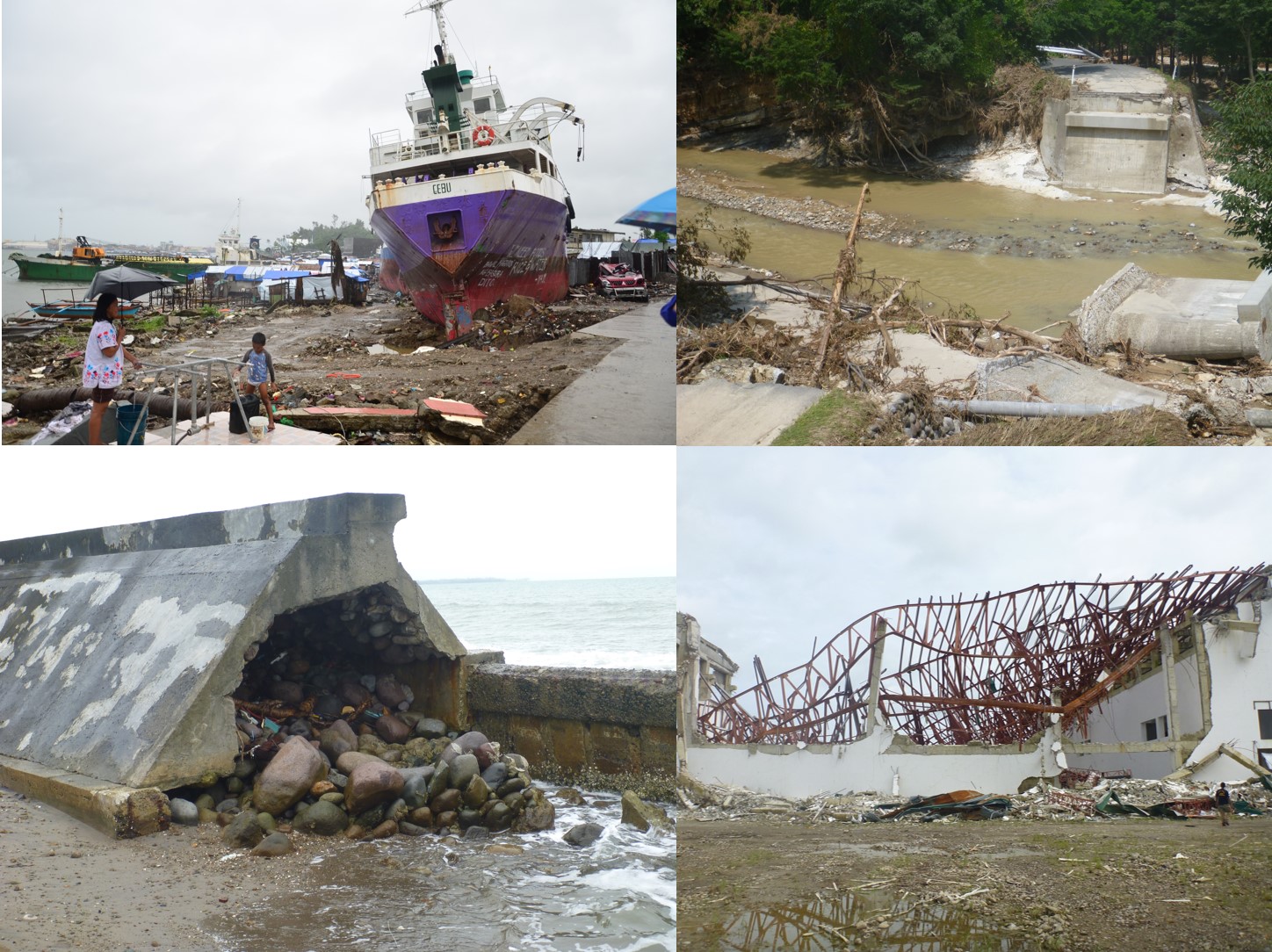
On-site Field Survey, Hazard Analysis, and Risk Evaluation
On-site field surveys and related analyses are conducted for Jakarta floods that took place in 2013, the storm surge from typhoon Haiyan in the Philippines, also in 2013, and the recent floods in Japan, in order to understand the disaster mechanisms, and evaluate the hazards, risks, and causes that multiply the damage.
Evaluation of flood risk and proposal of new hazard map
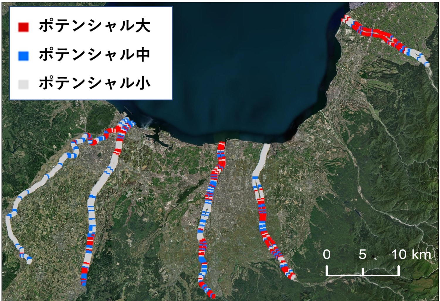
This study proposes a new risk rank evaluation method using flood inundation simulation results. The purpose of this study is to propose an adaptation measure to promote early evacuation in areas where residents typically underestimate flood risks and experience fewer disasters. As one of the adaptation measures to the climate change, we examined whether it is possible to improve the presentation of hazard maps and to promote evacuations.
Proposal of adaptation and mitigation measures for global warming
Impacts of global warming on river flooding in Toyama Prefecture are analyzed. Future flood risks are projected based on the numerical simulations under changing climate. And then, we propose several counter measures and adaptation plans in order to overcome the climate change.
Evaluation of the worst scenario flood disasters
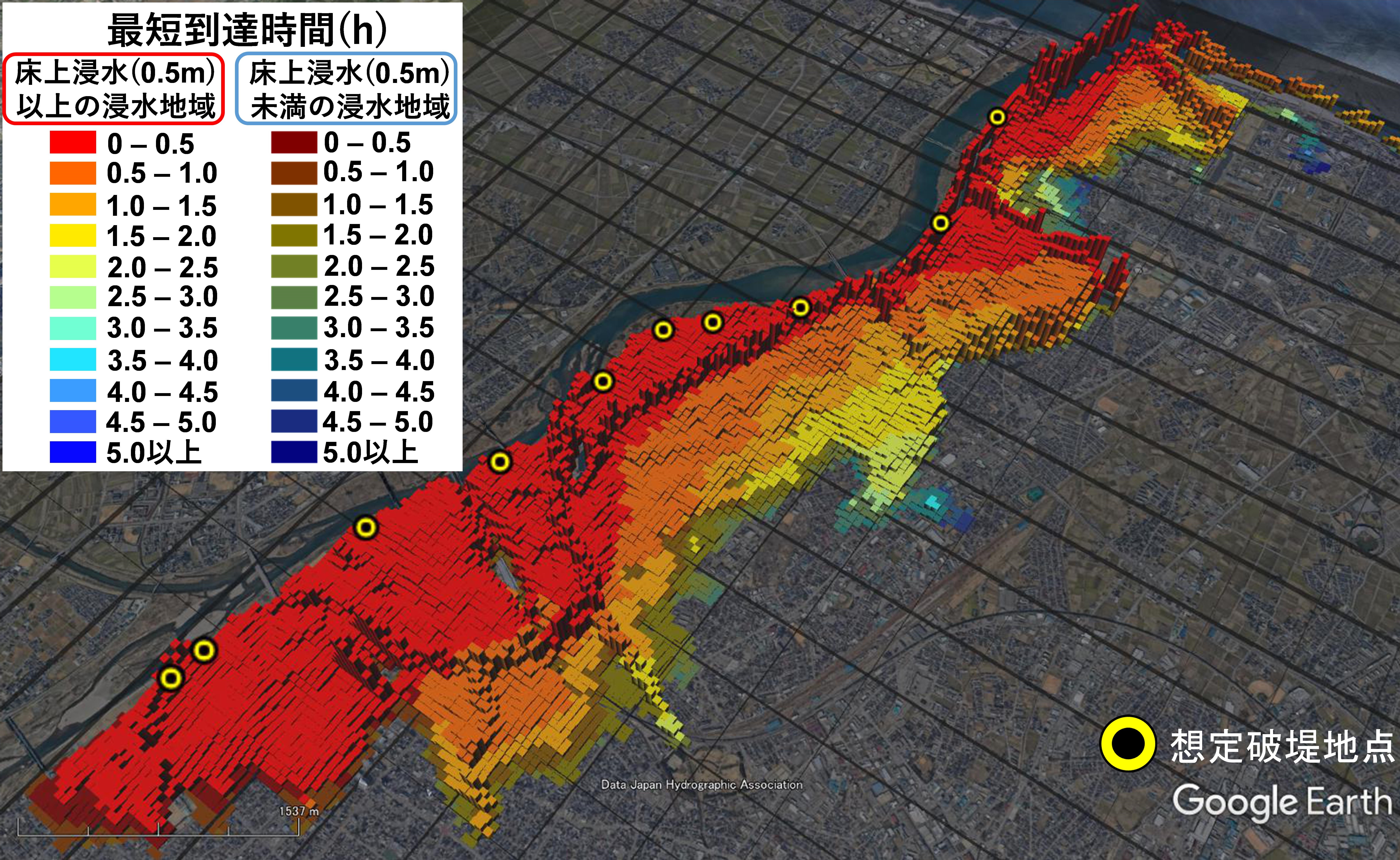
We are currently analyzing worst-case scenarios of floods by evaluating the probable maximum flood inundation based on the flood inundation model coupled with a regional climate model. We never want to have to say, "We did not expect or imagine a disaster of this magnitude would really happen." We would rather evaluate the hazard and risk in the target regions before the unexpected event ever happens.
The figure below shows the application results of the worst flood inundation model in the study area.
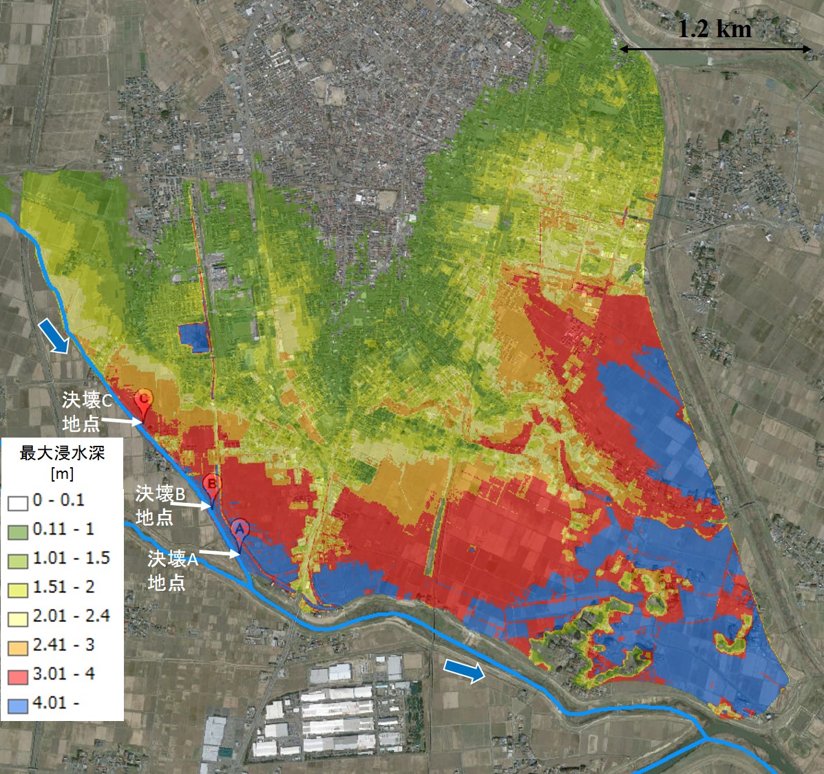
The figure below shows the application results of the worst flood inundation model in the study area.
Tsunami simulation in Toyama bay
We simulated tsunami propagation and inundation in the coastal area of the Toyama bay. We will consider and propose counter measures against a possible tsunami in this region.
The video below is a sample of the simulated tsunami propagation.
The video below is a sample of the simulated tsunami propagation.
Flood inundation simulation in Jakarta, Indonesia
A flood inundation simulation was conducted in Jakarta, Indonesia, to evaluate the flood hazards in this region and accordingly propose counter measures.
The video below is a sample of the simulated flood inundation in Jakarta.
The video below is a sample of the simulated flood inundation in Jakarta.
Development of a process-based rainfall runoff and flood inundation model
We are currently developing a process-based rainfall runoff and flood inundation model to understand flood mechanisms that will assist in reducing floods worldwide. Impacts of climate change, land usage/cover change, and human activities on floods and water resources such as basins are evaluated based on the developed model.
The video below is a sample of the simulated flood inundation in Japan.
The video below is a sample of the simulated flood inundation in Japan.